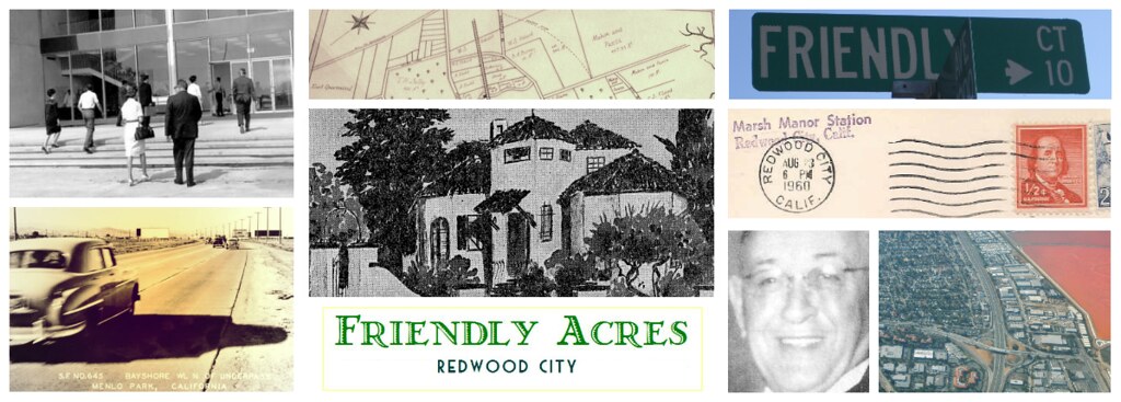

Friendly Acres Airport
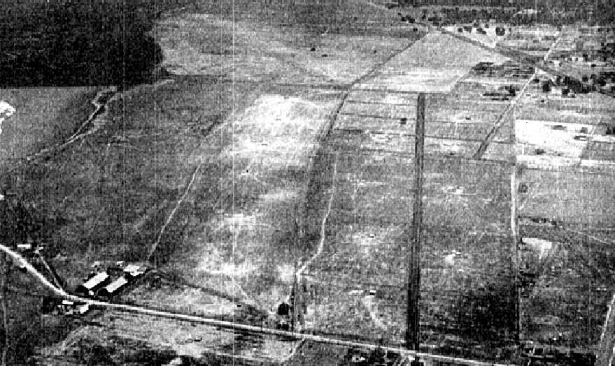
It was 1926 and both Daniel Stafford and the Redwood Committee had lost the bid to establish the San Francisco airport on Sweeny Ranch lands (read more in the post on Sweeny Ranch Airport) - lands that adjoined the Redwood City airport. That loss lead to the creation of the neighborhood we know as Friendly Acres.However the Second World War only served to resurrect those commercial airport aspirations. And at the end of the war, in the late summer and fall of 1945, David Dewey Bohannon proposed the idea of building an airport at the end of Marsh Road.
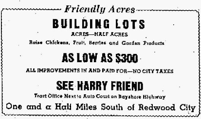
Bohannon, like Daniel Stafford before him, was a real estate developer who had purchased the Belle Haven Tract from Harry Friend who, in turn, had originally purchased Belle Haven in 1935 during the depression. Belle Haven represented the most easterly parcels of land of the old Sweeny Ranch (ranch lands carved out of the original Pulgas Rancho).
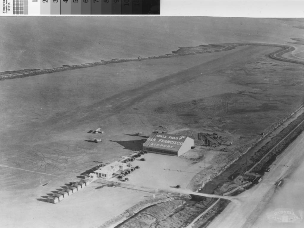
Despite the high and rapid turnover of owners, Redwood City airport, between Chestnut and Woodside road, had continued to operate during the 30s and 40s and the airfield was commonly referred to during the 2nd World War as Sanders' field.
No doubt influenced by the war time aviation activity, and the superb geographic conditions which the Navy had written about in 1916, coupled with Redwood City's 1925 slogan of "Climate Best by Government Test", Bohannon had pitched the idea of rezoning 72 acres of land north and east of Marsh Rd on the northern side of Bayshore Highway to create an airfield by the bay.
At 72 acres, the proposed extent of land for the Friendly Acres airport (what we know today as the Industrial Park area) would have been a little under four times the size of today's Bayfront Park, at the end of Marsh Road, which is about 22 acres.
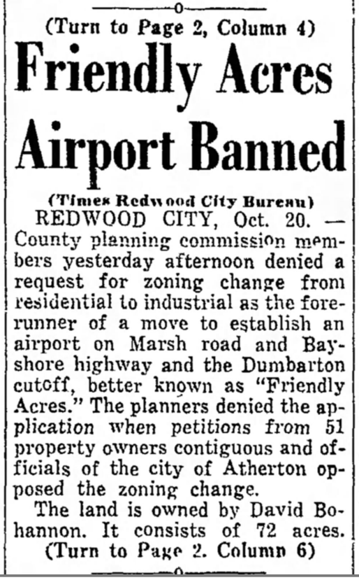
The Times, San Mateo, CA, Oct 20 1945
But Sander's Field, and the war in general, had given the residents of Friendly Acres its share of aviation mishaps: noise from low flying aircraft, plane crashes by flying aces (read about the crash landing here), and bombs being dropped on the neighborhood, (more about the warhead incident here) were just a few of the trials that befell local residents.
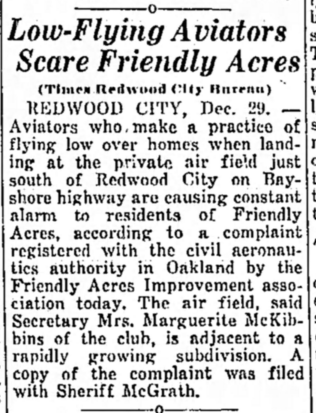 |
| The Times, San Mateo, CA, Dec 29 1939 |
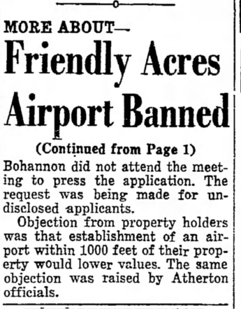
Inevitably, the combined communities of Friendly Acres and Atherton saw fit to deny Bohannon's application for an airfield citing noise and land value depreciation as objectionable.
Unable to develop the airport, Bohannon went on to build 1305 homes in the Belle Haven Tract, (today, in East Palo Alto and East Menlo Park), which they envisioned as "a home builder's paradise where wildflowers bloom year 'round..."
Sources:
- San Mateo County Genealogy, SF Place Names, Belle Haven: http://www.sfgenealogy.com/sanmateo/smplaces.htm
- Friendly Acres Airport Banned - San Mateo Times, Oct 20 1945
- Low Flying Aviator Scare Friendly Acres - San Mateo Times, Dec 29 1939